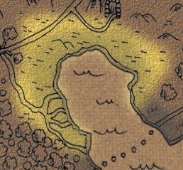
Map of the Manar lowlands.
The Manar lowlands are a littoral along a sea gulf, bordering the Argol woods, the Western forests, the Karantil ridge, the Elven hillsides and the Woods of Allovium. The Manar delta is located entirely within the region, also constituting its southwestern boundary.
Most of the population is human with an elven minority in the east. The local capital is the town of Milana, renowned for open air seafood markets and unique religious practices with their associated celebrations; in particular the yearly "exploding whale festival" deserves a mention.
The economy centers on fishing and large scale export of sea products. Oyster farms line up next to next at the northern coast. The main fishing and trade port is Eslana at the east coast. Agriculture and cattle breeding is mostly done on the hilly strip in the very north, as the flatlands are mainly marshes and swamps.
Although the Manar lowlands are entirely located within the temperate climate zone, the summers are quasi-tropical and very muggy due to the region being a huge basin. The winters are rather snowy and windy, but full snow coverage is rare because the sea climate generally prevents temperature drops below the freezing point.
| Regions of Eilana |
| Argol woods • Bitter plains • Downs of Urimel • Dwarven hillsides • Elven hillsides • Farmondel island • Geinaror ridge • Grimvil peninsula • Gusty hills • Isle of Emeril • Karantil mountain ridge • Land of the two streams • Land's end • Littoral of Orn • Lonely seas • Manar lowlands • Masnadil highs • Minat lowlands • Northern forests • Plains of Garmoskod • Swamps of Arthel • Tinran plains • Western forests • Woods of Allovium • Woods of Urtep |